
Overland Track
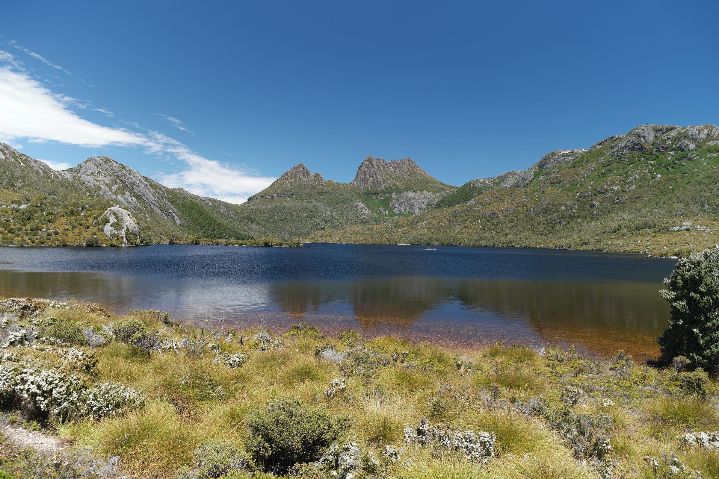
OSM hiking route in Cradle Mountain–Lake St Clair National Park, Tasmania (77.6 km line). Vertical figures sampled from Copernicus GLO-30. Days (6) is a placeholder from round(lengthKm/12), not the published 6-day Parks Tasmania window (unverified).
Last verified 2026-09-24 vs Parks & Wildlife Service Tasmania
Cite this record
The Hiking World, Overland Track, verified 2026-09-24, https://www.thehikingworld.com/trails/overland-track
How we verify · last checked 2026-09-24
Byline
- The Hiking World editorial · author
Desk byline for seed records. Named surveying editors replace this once a trail is verified.
Figures marked provisional are seed data and still need verification. Source and last-checked date sit under each cited value.
Weather forecast
Loading live forecast…
Permits and fees
Quota / restriction: 1 Oct–31 May: north→south one-way only, max 34 walkers/departure, booking fee incl. park entry; off-season free/either direction.
| Permit | Cost | Quota / restriction | Issuer | Source | Verified |
|---|---|---|---|---|---|
| Adult booking (in season)Official source | AUD 280≈ US$187 on the first figure, rate as of 2026-09-24 | — | Not recorded | Not recorded | Verified 2026-09-23 vs Not recorded |
Gear mandates
Huts cannot be booked and may fill; you must carry a tent even with an Overland Track Pass (Parks Tasmania Overland Track page and FAQ).
parks.tas.gov.au · verified 2026-08-24
Official mandate only — not a packing-list opinion.
Line download is the stored OSM geometry, simplified. It is not a surveyed GPS track. GPX · GeoJSON
Editorial v1 · Provisional catalog
Grade 4 alpine bushwalk
- SAC T2–T3 (mapped — no official SAC grade)
- Mountain hiking. Continuous trail, some steep ground, sure-footedness helpful. through Demanding mountain hiking. Exposed sections possible; hands may be needed for balance.
- YDS Class 1
- Class 1. Walking on an established path; low fall risk.
Log in to view the elevation profile
Ingested from OpenStreetMap relation 1673569 (ODbL). The mapped line and 2D length are derived from that geometry. Ascent, descent, and high/low points are sampled from Copernicus GLO-30 (copernicus-dem:glo-30) and remain provisional. Water, permits, and hazards were not taken from OSM tags and must be verified.
OSM 2D length is 77.6 km (relation 1673569; numbered Overland Track sections 1–6 stitched, Wikidata Q491216). Endpoints are Cradle Mountain / Ronny Creek to the Lake St Clair visitor centre (Cynthia Bay). Published 65 km / 6 days (https://parks.tas.gov.au/explore-our-parks/cradle-mountain/overland-track, checked 2026-08-24) usually treat Narcissus Hut as the walk's end plus a booked ferry; the extra OSM length is that lakeside continuation, not a Mount Ossa spur. Those figures are cross-checks only, not this DataPoint.
typicalDays 6 is the published typical: Parks Tasmania says most walkers take six days (https://parks.tas.gov.au/explore-our-parks/cradle-mountain/overland-track, checked 2026-08-24). Not a DataPoint. Booking season 1 October–31 May (north→south); the track is open year-round with a winter register (same page).
Water was not mapped to named WaterSource points (no honest atFraction). Official notes mention freshwater tanks at huts; they were not positioned here.
Water security
Sourced carry / availability
Parks Tasmania notes freshwater tanks at huts; they were not positioned as named WaterSource points on this record.
parks.tas.gov.au · verified 2026-08-24Surface
Surface is not recorded. This field is filled only from an OSM surface tag, not from the grade.
Permits & fees
- Permit
- Overland Track booking
Log in to view cost, booking, and issuer
Getting there
Sourced legs to the Cradle Mountain / Ronny Creek (OSM line start) base start station — where this trail record begins. This is not a route planner: durations are approximate and marked provisional until an official transport page confirms them.
Bus · Launceston (LST) → Cradle Mountain Visitor Centre
Parks Tasmania: coach transport to and from Cradle Mountain and Lake St Clair visitor centres is available year-round from Hobart, Launceston and Devonport (https://parks.tas.gov.au/explore-our-parks/cradle-mountain/overland-track, checked 2026-08-24). Named operators are listed on the PWS plan-your-trip page; confirm current timetables before travel.
parks.tas.gov.au · verified 2026-08-24 · official · provisionalBus · Hobart (HBA) → Cradle Mountain Visitor Centre
Same Parks Tasmania Overland Track page: transport from Hobart as well as Launceston and Devonport (checked 2026-08-24).
parks.tas.gov.au · verified 2026-08-24 · official · provisionalBus · Cradle Mountain Visitor Centre → Ronny Creek trailhead
In-park shuttle from the Visitor Centre to Ronny Creek is included in the Overland Track booking fee during the booking season (same page, checked 2026-08-24).
parks.tas.gov.au · verified 2026-08-24 · official · provisional
No rail to Cradle Mountain. Book the Lake St Clair ferry separately if finishing at Narcissus rather than walking to Cynthia Bay (Parks Tasmania, checked 2026-08-24).
Plan from your location
Type a city, then pick a match. These links open external search tools — they do not fetch fares or timetables.
Getting there car-free
Ronny Creek Registration Booth · car-free flag: yes
Grok pin. Parks Tasmania shuttle from the Cradle Mountain Visitor Centre to Ronny Creek is included in the Overland Track booking fee in season.
Narcissus Hut · car-free flag: unknown
Usual ferry finish. Grok pin.
Lake St Clair Visitor Centre · car-free flag: unknown
OSM line continues to Cynthia Bay. Grok pin.
Trailheads
- Ronny Creek Registration Booth car-free: yes
- Narcissus Hut car-free: unknown
- Lake St Clair Visitor Centre car-free: unknown
Log in to view trailhead transit detail
Hazards
- Variable alpine weather including summer snow; severe cold, wet, and windy conditions can happen at any time of year. Deaths have occurred, including in summer, when walkers were not prepared (https://parks.tas.gov.au/explore-our-parks/cradle-mountain/overland-track, checked 2026-08-24).
- Deep mud, exposed alpine sections, steep and rocky ground — Grade 4 (same page, checked 2026-08-24).
- In the booking season (1 October–31 May) independent walkers must travel north to south, Cradle Mountain to Lake St Clair (https://parks.tas.gov.au/explore-our-parks/cradle-mountain/overland-track/frequently-asked-questions, checked 2026-08-24).
Questions
Do I need a permit for Overland Track?
A permit is listed as required for Overland Track: Overland Track booking. Status on this record is an official source.
How much is the Overland Track permit?
Adult booking (in season): AUD 280 (Not recorded, verified 2026-09-23). Status: verified-official.
Overland Track permit quota and booking
1 Oct–31 May: north→south one-way only, max 34 walkers/departure, booking fee incl. park entry; off-season free/either direction.
When is the best time to hike Overland Track?
On this record the best season is: Booking season 1 Oct–31 May (N→S); open year-round, winter register.
How difficult is Overland Track?
Overland Track is graded Parks Tasmania: Grade 4 · SAC T2–T3 (mapped — no official SAC grade) · YDS 1. A sourced hazard on this record: Variable alpine weather including summer snow; severe cold, wet, and windy conditions can happen at any time of year. Deaths have occurred, including in summer, when walkers were not prepared (https://parks.tas.gov.au/explore-our-parks/cradle-mountain/overland-track, checked 2026-08-24).
How long is Overland Track?
The OSM 2-D length on this record is 77.6 km (provisional). Published figures may differ. See /guides/how-long-is-the-trail
How do I get to Overland Track?
The record’s base start is Cradle Mountain / Ronny Creek (OSM line start). A primary gateway on the record is Launceston Airport (LST). Trailhead transit notes are not included in this public FAQ.
Related trails
- Alternate Larapinta Trail Section 7 North · Australia
- Alternate spurs for Larapinta Trail · Australia
- Alternative High Route Larapinta Trail Section 3 · Australia
- Art in the Park Walk · Australia
- Australian Alps Walking Track · Australia
- Bay of Fires Walk · Australia