
Mount Kenya (Sirimon–Chogoria)
Curated schematic — not walking distance. Pin-to-pin OSM named-waypoint line from Old Moses Camp over Point Lenana to Chogoria Gate, 26.6 km. Sirimon and Chogoria hiking relations were not stitched. Vertical figures are a GLO-30 sample of those pins, not a walking profile. typicalDays 6 is the published 5–6 day window (typical, not a statute).
Byline
- The Hiking World editorial · author
Desk byline for seed records. Named surveying editors replace this once a trail is verified.
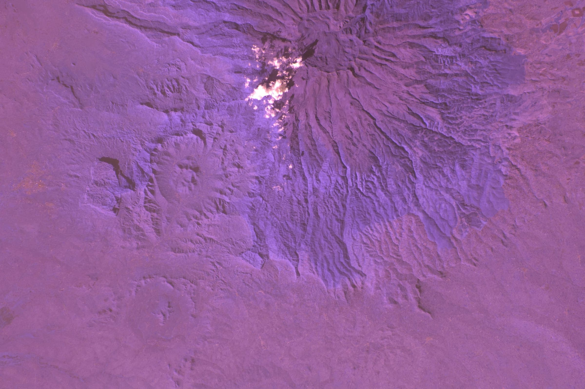
Figures marked provisional are seed data and still need verification. Source and last-checked date sit under each cited value.
Altitude weather delta
High 4,949 m minus low 2,988 m is 1,961 m of relief on this record. A standard tropospheric lapse of 6.5 °C per 1,000 m implies about 12.7 °C cooler at the high point than the valley, all else equal.
That is a model (International Standard Atmosphere environmental lapse), not a forecast and not a trail-closure. Wind, snow, and storms stay in Hazards.
derived:lapse-rate · 2026-09-10 · provisionalISA 6.5 °C / 1,000 m · wikipedia.org · 2026-09-10
Editorial v1 · Provisional catalog
- SAC T3 (mapped — no official SAC grade)
- Demanding mountain hiking. Exposed sections possible; hands may be needed for balance.
- YDS Class 2
- Class 2. Simple scrambling, occasional use of hands.
Where the walking ends
This record covers the walk to Point Lenana (4,985 m). Beyond that, the continuation is mountaineering, which we do not map as a trail — it needs a technical climb on Batian and Nelion, not a walk. Point Lenana is the trekker summit.
Source: en.wikipedia.org · checked 2026-09-17
We have not verified the technical section. Where hiking ends · Walk-up & trekker summits
Log in to view the elevation profile
Curated schematic from named OpenStreetMap nodes (ODbL). The line is pin-to-pin, not a walking path. 2-D length is labelled schematic — not walking distance. Ascent, descent, and high/low points are Copernicus GLO-30 samples at those vertices only (copernicus-dem:glo-30) and remain provisional. Water, permits, and hazards were not taken from OSM tags and must be verified.
No single connected Sirimon–Chogoria hiking relation resolved on 2026-09-11. OSM holds separate hiking relations Sirimon (416424) and Chogoria (416423); they were not stitched. Geometry is an ordered pin-to-pin line through OSM-resolved named nodes: Old Moses Camp → Shipton's Camp → Point Lenana → Chogoria Gate. 2-D length 26.6 km is schematic — not walking distance. Operator figures of ~80 km and ~97 km disagree; both are Unverified cross-checks, not this DataPoint — the disagreement is shown, not silently picked. osmRelationId is unset. Never graduate to verified without a single connected OSM hiking relation.
Sirimon Gate did not resolve as a named OSM node and was not used; the schematic starts at Old Moses Camp (Sirimon hut). Chogoria Gate is OSM node 4788310740 (not building way 486117658).
typicalDays 6 is the published typical 5–6 day window, not a DataPoint. Drier January–February and August–September windows are widely described; they were not copied from a KWS statute this pass.
GLO-30 high 4,949 m is 36 m under the commonly cited Point Lenana ~4,985 m on a 4-vertex sample, not a walking profile. High point left as Copernicus, not overwritten. Cumulative DEM ascent 1,564 m / descent 1,961 m is an under-count versus published walking gain; do not treat it as that figure.
Water was not mapped to named WaterSource points (no honest atFraction). Huts exist on published descriptions; they were not positioned from an official named list this pass.
Water
No water sources recorded.
Permits & fees
- Permit
- KWS park entry + certified guide
Log in to view cost, booking, and issuer
Getting there
Sourced legs to the Old Moses Camp (schematic start) base start station — where this trail record begins. This is not a route planner: durations are approximate and marked provisional until an official transport page confirms them.
Road · Nairobi (NBO) → Sirimon / Old Moses Camp
Jomo Kenyatta International Airport is the usual international air gateway (https://en.wikipedia.org/wiki/Jomo_Kenyatta_International_Airport, checked 2026-09-11, CC BY-SA). Road continues toward Nanyuki / Sirimon Gate; this pin is the OSM hut, not the unresolved Gate.
en.wikipedia.org · 2026-09-11 · wikidata · official · provisional
KWS: certified guide required; conservation / park-entry tariffs are published (https://www.kws.go.ke/mount-kenya-national-park-reserve, checked 2026-09-11). Amounts are not copied here — confirm the live eCitizen tariff.
Plan from your location
Type a city, then pick a match. These links open external search tools — they do not fetch fares or timetables.
Trailheads
- Old Moses Camp (schematic start) car-free: unknown
- Chogoria Gate (schematic end) car-free: unknown
Log in to view trailhead transit detail
Hazards
- Altitude / AMS: GLO-30 high 4,949 m at the Point Lenana pin (4-vertex schematic sample). The commonly cited trekker summit is about 4,985 m. Surface as a safety fact, not a grade.
- Certified guide: KWS requires all visitors to enter with a qualified and certified guide (https://www.kws.go.ke/mount-kenya-national-park-reserve, checked 2026-09-11).
Questions
Do I need a permit for Mount Kenya (Sirimon–Chogoria)?
A permit is required for Mount Kenya (Sirimon–Chogoria): KWS park entry + certified guide. Cost, booking, and issuer stay behind the login gate on this page.
When is the best time to hike Mount Kenya (Sirimon–Chogoria)?
On this record the best season is: Widely described drier Jan–Feb and Aug–Sep.
How difficult is Mount Kenya (Sirimon–Chogoria)?
Mount Kenya (Sirimon–Chogoria) is graded SAC T3 (mapped — no official SAC grade) · YDS 2. A sourced hazard on this record: Altitude / AMS: GLO-30 high 4,949 m at the Point Lenana pin (4-vertex schematic sample). The commonly cited trekker summit is about 4,985 m. Surface as a safety fact, not a grade.
How long is Mount Kenya (Sirimon–Chogoria)?
This figure is 26.6 km (provisional): a schematic straight-line estimate between waypoints — not a measured walking distance; published figures are the better guide. See /guides/how-long-is-the-trail
How do I get to Mount Kenya (Sirimon–Chogoria)?
The record’s base start is Old Moses Camp (schematic start). A primary gateway on the record is Jomo Kenyatta International Airport (NBO). Trailhead transit notes are not included in this public FAQ.
Related trails
- Ala-Kul Lake Trek · Same collection
- Alta Via 1 · Same collection
- Everest Base Camp Trek · Same collection
- Fishermen's Trail · Same collection
- GR20 · Same collection
- Inca Trail (Classic 4-day) · Same collection
Featured in
Related links
- OfficialKWS — Mount Kenya National Park & Reservekws.go.ke · 2026-09-11 · official · provisional
- OfficialKWS conservation fees (October 2025 schedule)kws.go.ke · 2026-09-11 · official · provisional