
Fishermen's Trail
Trilho dos Pescadores
OSM hiking route along Portugal's southwest Atlantic coast (222.1 km line), São Torpes to Lagos. Vertical figures sampled from Copernicus GLO-30. Days (19) is a placeholder from round(lengthKm/12), not the published 13-stage window (unverified).
Last verified 2026-09-24 vs Rota Vicentina
Cite this record
The Hiking World, Fishermen's Trail, verified 2026-09-24, https://www.thehikingworld.com/trails/fishermens-trail
How we verify · last checked 2026-09-24
Byline
- The Hiking World editorial · author
Desk byline for seed records. Named surveying editors replace this once a trail is verified.
Figures marked provisional are seed data and still need verification. Source and last-checked date sit under each cited value.
Weather forecast
Loading live forecast…
Permits and fees
| Permit | Cost | Quota / restriction | Issuer | Source | Verified |
|---|---|---|---|---|---|
| No walking permitUnverified — not officially sourced | Not recorded | — | Rota Vicentina | Issuer page | Unverified |
Local ethics / Leave No Trace
No wild camping. The Fishermen’s Trail is inside the Southwest Alentejo and Vicentine Coast Natural Park (Rota Vicentina trail page and camping FAQ).
rotavicentina.com · verified 2026-08-24
Line download is the stored OSM geometry, simplified. It is not a surveyed GPS track. GPX · GeoJSON
Editorial v1 · Provisional catalog
Somewhat difficult coastal walk
- SAC T1–T2 (mapped — no official SAC grade)
- Hiking. Trail well cleared, flat or slightly sloped, no fall hazard. through Mountain hiking. Continuous trail, some steep ground, sure-footedness helpful.
- YDS Class 1
- Class 1. Walking on an established path; low fall risk.
Log in to view the elevation profile
Assembled from 13 OpenStreetMap relations (ODbL), stages 1–13 in order; no single parent relation exists in OSM. The mapped line and 2D length are derived from that geometry. Ascent, descent, and high/low points are sampled from Copernicus GLO-30 (copernicus-dem:glo-30) and remain provisional. Water, permits, and hazards were not taken from OSM tags and must be verified.
OSM 2D length is 222.1 km (ordered stitch of Fishermen's Trail stages 1–13: relations 20810605, 20810602, 20810603, 20810601, 20810600, 20810599, 20810598, 20810597, 20810596, 20810595, 20810594, 20810593, 20810592; osmRelationId 20810605 is stage 1 because OSM has no parent superroute; stage-to-stage connectors 0.0 km). Historical Way superroute 7592697 and Alternativa 14766420 were not fetched. lengthKm is verified: 222.1 km is within ~3% of Rota Vicentina 226.5 km (independent published figure; 0-gap stage stitch; https://rotavicentina.com/en/fishermens-trail/, checked 2026-08-24). Published 13 stages remain a window, not a DataPoint. Endpoints are Praia de São Torpes to Lagos.
DEM high 158 m / low 0 m is a coastal cliff sample, not a mountain line. GLO-30 cumulative ascent 3,925 m is raster gain along a low shore path and is not a published climbing figure.
typicalDays 13 is the published typical: the official page lists 13 one-day stages (maximum 22.5 km) walkable September–June (https://rotavicentina.com/en/fishermens-trail/, checked 2026-08-24). Not a DataPoint. Avoid peak summer heat; the official walking months are September–June (same page).
Water was not mapped to named WaterSource points (no honest atFraction). Villages between stages exist; they were not positioned from an official named list this pass.
Water
No water sources recorded.
Surface
Surface is not recorded. This field is filled only from an OSM surface tag, not from the grade.
Permits & fees
No permit required.
Getting there
Sourced legs to the Praia de São Torpes (OSM line start) base start station — where this trail record begins. This is not a route planner: durations are approximate and marked provisional until an official transport page confirms them.
Bus · Lisbon (LIS) → Sines
Rede Expressos. Lisbon Humberto Delgado is Portugal's main international airport (https://en.wikipedia.org/wiki/Humberto_Delgado_Airport, checked 2026-08-24). Rede Expressos is the nationwide coach network with services toward the Alentejo coast including Sines (https://en.wikipedia.org/wiki/Rede_Expressos, checked 2026-08-24). Confirm the current timetable before travel.
en.wikipedia.org · verified 2026-08-24 · wikidata · official · provisionalRoad · Sines → Praia de São Torpes
Official Fishermen's Trail stage 1 starts at Praia de São Torpes (https://rotavicentina.com/en/fishermens-trail/, checked 2026-08-24). Local taxi from Sines; no rail to the beach.
rotavicentina.com · verified 2026-08-24 · official · provisional
No rail to São Torpes. The trail is walkable both directions September–June (same official page, checked 2026-08-24).
Plan from your location
Type a city, then pick a match. These links open external search tools — they do not fetch fares or timetables.
Getting there car-free
Praia de São Torpes (OSM line start) · car-free flag: unknown
Official stage 1 starts at Praia de São Torpes (OSM from=Praia de São Torpes; https://rotavicentina.com/en/fishermens-trail/, checked 2026-08-24). Taxi from Sines.
Lagos (OSM line end) · car-free flag: unknown
Official stage 13 ends at Lagos (https://rotavicentina.com/en/fishermens-trail/, checked 2026-08-24).
Trailheads
- Praia de São Torpes (OSM line start) car-free: unknown
- Lagos (OSM line end) car-free: unknown
Log in to view trailhead transit detail
Hazards
- 60–70% of the trail is sandy and more demanding physically (https://rotavicentina.com/en/fishermens-trail/, checked 2026-08-24).
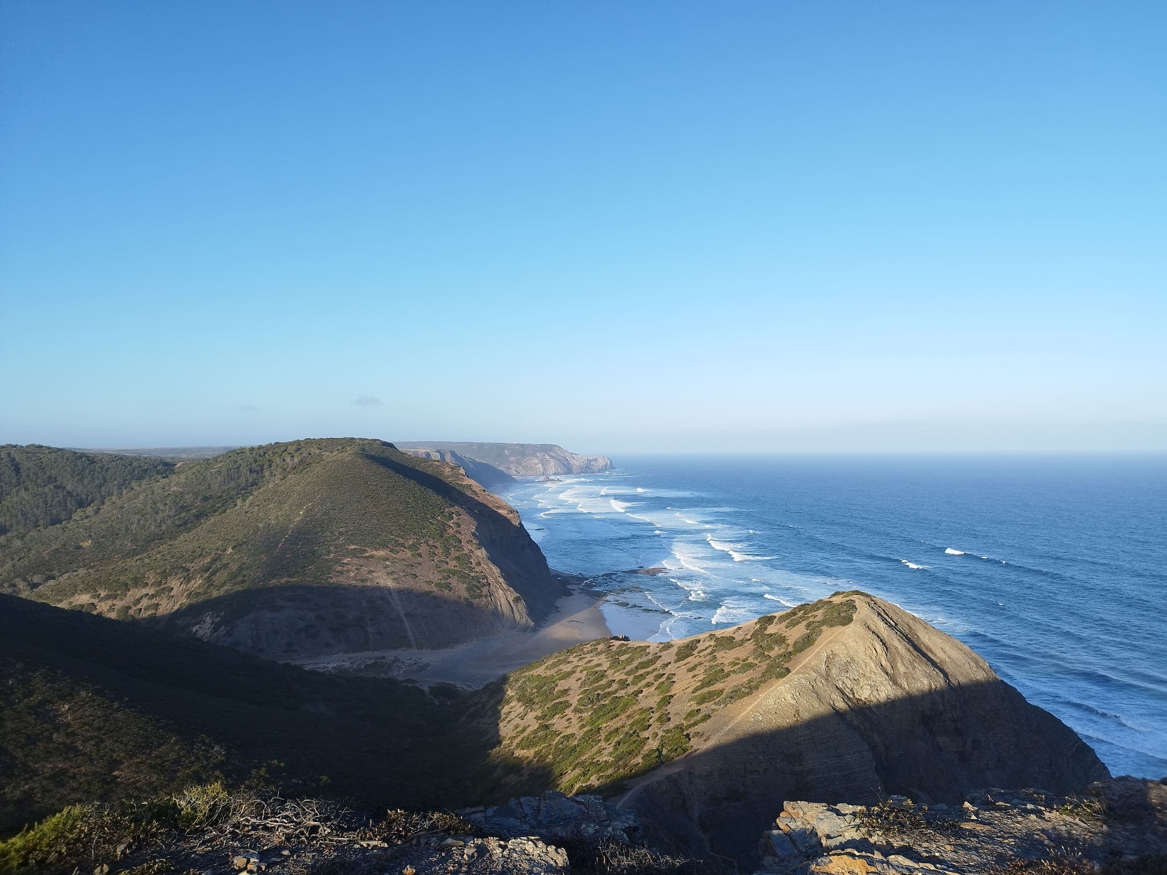
- The cliffs are in a constant process of erosion — walking along them, be careful of the danger of falling (same official page, checked 2026-08-24).
- Not recommended for people with vertigo or fear of heights (same page, checked 2026-08-24).
- Permanent contact with Atlantic wind; exclusively on foot — trail running is not compatible with the care this ecosystem requires; maximum 15 people per group; vehicles in the dunes prohibited (same page, checked 2026-08-24).
Questions
Do I need a permit for Fishermen's Trail?
No trail permit is listed as required on this record for Fishermen's Trail.
When is the best time to hike Fishermen's Trail?
On this record the best season is: Sep–Jun; avoid peak summer heat.
How difficult is Fishermen's Trail?
Fishermen's Trail is graded Rota Vicentina: medium / somewhat difficult · SAC T1–T2 (mapped — no official SAC grade) · YDS 1. A sourced hazard on this record: 60–70% of the trail is sandy and more demanding physically (https://rotavicentina.com/en/fishermens-trail/, checked 2026-08-24).
How long is Fishermen's Trail?
The OSM 2-D length on this record is 222.1 km (verified). Published figures may differ. See /guides/how-long-is-the-trail
How do I get to Fishermen's Trail?
The record’s base start is Praia de São Torpes (OSM line start). A primary gateway on the record is Humberto Delgado Airport (LIS). Trailhead transit notes are not included in this public FAQ.
Related trails
- Ala-Kul Lake Trek · Same collection
- Alta Via 1 · Same collection
- Everest Base Camp · Same collection
- GR20 · Same collection
- Inca Trail (Classic 4-day) · Same collection
- K2 Base Camp / Concordia · Same collection