
Torres del Paine W Trek
Circuito W
Four-to-five day traverse of the Paine massif, linking the Torres viewpoint, the French Valley, and Grey Glacier.
Last verified 2026-01-01 vs CONAF, Vertice, Las Torres
Cite this record
The Hiking World, Torres del Paine W Trek, verified 2026-01-01, https://www.thehikingworld.com/trails/torres-del-paine-w
How we verify · last checked 2026-01-01
Byline
- The Hiking World editorial · author
Desk byline for seed records. Named surveying editors replace this once a trail is verified.
Figures marked provisional are seed data and still need verification. Source and last-checked date sit under each cited value.
Permits and fees
| Permit | Cost | Quota / restriction | Issuer | Source | Verified |
|---|---|---|---|---|---|
| CONAF park entry + campsite bookingsUnverified — not officially sourced | Park entry approx. CLP 35,000 (foreign, high season) | — | CONAF, Vertice, Las Torres | Not recorded | Unverified |
Altitude weather delta
High 880 m minus low 30 m is 850 m of relief on this record. A standard tropospheric lapse of 6.5 °C per 1,000 m implies about 5.5 °C cooler at the high point than the valley, all else equal.
That is a model (International Standard Atmosphere environmental lapse), not a forecast and not a trail-closure. Wind, snow, and storms stay in Hazards.
derived:lapse-rate · 2026-09-10 · provisionalISA 6.5 °C / 1,000 m · wikipedia.org · 2026-09-10
Line download is the stored OSM geometry, simplified. It is not a surveyed GPS track. GPX · GeoJSON
Editorial v1 · Provisional catalog
- SAC T2
- Mountain hiking. Continuous trail, some steep ground, sure-footedness helpful.
- YDS Class 1
- Class 1. Walking on an established path; low fall risk.
Log in to view the elevation profile
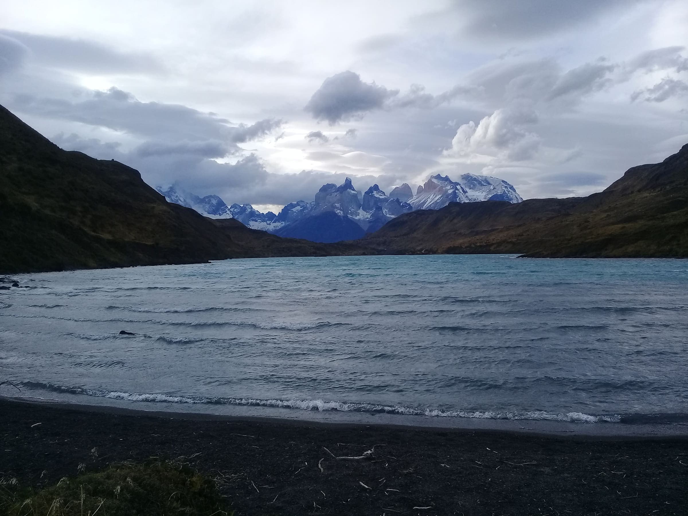
The W follows the southern flank of the Cordillera del Paine. The name comes from the three arms the route traces on a map. Huts and campsites serve the walk. Distance is rarely the limiter: campsites must be booked in advance with two operators plus the park, and a catamaran links Paine Grande to Pudeto.
Patagonian weather is constant context. Winds over 100 km/h are common near Grey. The exposed climb to Mirador Las Torres is often hard because of wind, not grade.
Water
- Río Ascencioyear-roundtreat: not-needed
- Refugio Greyyear-roundtreat: recommended
Log in to view treatment notes and access detail
Surface
Surface is not recorded. This field is filled only from an OSM surface tag, not from the grade.
Permits & fees
- Permit
- CONAF park entry + campsite bookings
Log in to view cost, booking, and issuer
Getting there
Sourced legs to the Laguna Amarga / Las Torres base start station — where this trail record begins. This is not a route planner: durations are approximate and marked provisional until an official transport page confirms them.
Bus · Punta Arenas airport (PUQ) → Puerto Natales bus terminal
Bus Sur, Buses Pacheco, Buses Fernández. About 3.75 h. About 3.5–4 h / 250 km. No direct bus PUQ→park. Pacheco runs airport-direct; Fernández from the PA terminal.
torresdelpaine.com · 2026-08-20 · official · provisionalBus · Puerto Natales → Laguna Amarga / Pudeto park entrance
Bus Sur. About 3 h. several daily in peak season (Oct–Apr). 2–4 h depending on entrance. Eastern W start is Laguna Amarga.
swoop-patagonia.com · 2026-08-20 · official · provisional
Plan from your location
Type a city, then pick a match. These links open external search tools — they do not fetch fares or timetables.
Getting there car-free
Laguna Amarga / Las Torres · car-free flag: seasonal
Bus from Puerto Natales to Laguna Amarga, then shuttle.
Pudeto (catamaran) · car-free flag: yes
Catamaran to Paine Grande for the west-to-east direction.
Trailheads
- Laguna Amarga / Las Torres car-free: seasonal
- Pudeto (catamaran) car-free: yes
Log in to view trailhead transit detail
Hazards
- Extreme, sudden wind
- Hypothermia in exposed sectors
- River crossings after rain
Questions
Do I need a permit for Torres del Paine W Trek?
A permit is listed as required for Torres del Paine W Trek: CONAF park entry + campsite bookings. Status is unverified. This desk does not treat that as an official ruling.
When is the best time to hike Torres del Paine W Trek?
On this record the best season is: Nov-Mar (austral summer).
How difficult is Torres del Paine W Trek?
Torres del Paine W Trek is graded SAC T2 · YDS 1. A sourced hazard on this record: Extreme, sudden wind
How long is Torres del Paine W Trek?
The length on this record is 80 km (provisional). Published figures may differ. See /guides/how-long-is-the-trail
How do I get to Torres del Paine W Trek?
The record’s base start is Laguna Amarga / Las Torres. A primary gateway on the record is Presidente Carlos Ibáñez del Campo International Airport (PUQ). Trailhead transit notes are not included in this public FAQ.
Related trails
- Ala-Kul Lake Trek · Same collection
- Alta Via 1 · Same collection
- Everest Base Camp · Same collection
- Fishermen's Trail · Same collection
- GR20 · Same collection
- Inca Trail (Classic 4-day) · Same collection