
Rachakonda Fort
రాచకొండ
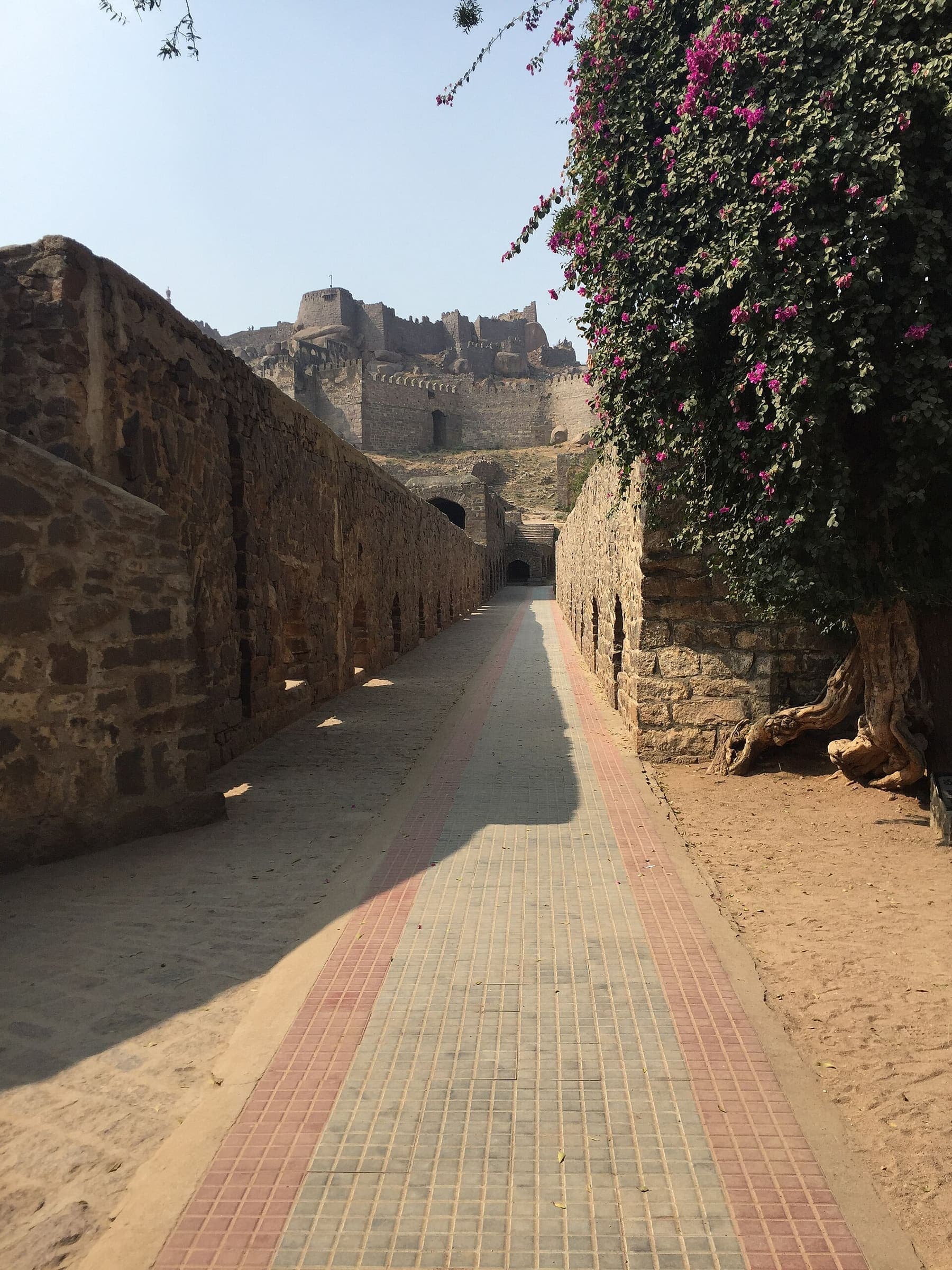
Day climb to a 14th-century hill fort in Yadadri Bhuvanagiri district. No OSM hiking path; map pins are sourced place coordinates, not a walking track. Days (1) is a day-trek stamp, not a thru-window.
Last verified 2026-08-20 · no issuer named on the permit
Cite this record
The Hiking World, Rachakonda Fort, verified 2026-08-20, https://www.thehikingworld.com/trails/rachakonda-fort
How we verify · last checked 2026-08-20
Byline
- The Hiking World editorial · author
Desk byline for seed records. Named surveying editors replace this once a trail is verified.
Figures marked provisional are seed data and still need verification. Source and last-checked date sit under each cited value.
Permits and fees
| Permit | Cost | Quota / restriction | Issuer | Source | Verified |
|---|---|---|---|---|---|
| Unverified (not sourced from OSM)Unverified — not officially sourced | Not recorded | — | Not recorded | Not recorded | Unverified |
Line download is the stored OSM geometry, simplified. It is not a surveyed GPS track. GPX · GeoJSON
Editorial v1 · Provisional catalog
- SAC T2
- Mountain hiking. Continuous trail, some steep ground, sure-footedness helpful.
- YDS Class 1
- Class 1. Walking on an established path; low fall risk.
Log in to view the elevation profile
Option B ingest (2026-08-20): Overpass found no route=hiking relation and no named highway=path. Geometry is pin-to-pin from OSM node 5395682099 (named Rachakonda) to the Wikipedia / Wikidata Q7279103 coordinate for Rachakonda Fort (17.18222°N 78.80250°E). That 2D length is not a walking distance. Indiahikes ~2.5 km is a lead only and was not written into a DataPoint.
History is attributed, not a DataPoint: Wikipedia (https://en.wikipedia.org/wiki/Rachakonda_Fort, checked 2026-08-20) dates the fort to around 1360 and names Recherla Anapotanayaka. Verticals are Copernicus GLO-30 at the two pins (~550 m); they do not measure the rock steps. Carry water; no named WaterSource was cited on an official page.
Water
No water sources recorded.
Surface
Surface is not recorded. This field is filled only from an OSM surface tag, not from the grade.
Permits & fees
Permit status is unverified. Permit and fee fields were not sourced from OSM. Confirm locally before travel. Official tariff pages were not fetched or did not state a walking/entry fee this pass; left unverified rather than asserted.
Getting there
Sourced legs to the Rachakonda (OSM place node) base start station — where this trail record begins. This is not a route planner: durations are approximate and marked provisional until an official transport page confirms them.
Road · Hyderabad → Rachakonda
About 60 km via Nagarjuna Sagar highway (Choutuppal / Tippaiguda). No direct public transport to the fort — private vehicle/taxi. Nearest rail is distant.
RESEARCH_TELANGANA_DECCAN.md · 2026-08-20 · provisional
Plan from your location
Type a city, then pick a match. These links open external search tools — they do not fetch fares or timetables.
Getting there car-free
- Rachakonda (OSM place node): car-free flag unknown. No transit note stored, so this is not a way to get there.
Trailheads
- Rachakonda (OSM place node) car-free: unknown
Log in to view trailhead transit detail
Hazards
Questions
Do I need a permit for Rachakonda Fort?
Permit status is unverified for Rachakonda Fort. This desk does not assert that a walking permit is or is not required.
How difficult is Rachakonda Fort?
Rachakonda Fort is graded SAC T2 · YDS 1.
How long is Rachakonda Fort?
The length on this record is 1.1 km (provisional). Published figures may differ. See /guides/how-long-is-the-trail
How do I get to Rachakonda Fort?
The record’s base start is Rachakonda (OSM place node). A primary gateway on the record is Rajiv Gandhi International Airport (HYD). Trailhead transit notes are not included in this public FAQ.
Related trails
- Aad Fort · India
- Ainkai Tankai Fort · India
- Akshu La · India
- Anghai fort · India
- Asaavagad Fort · India
- Asherigad Fort · India