
Laugavegur
Лёйгавегюр · ロイガヴェーグル · Льойгавеґур
OSM hiking route in the Icelandic Highlands (52.8 km line). Vertical figures sampled from Copernicus GLO-30. typicalDays 4 is the published FÍ typical (range 2–4 hut-to-hut days, not a DataPoint).
Last verified 2026-09-24 · no issuer named on the permit
Cite this record
The Hiking World, Laugavegur, verified 2026-09-24, https://www.thehikingworld.com/trails/laugavegur
How we verify · last checked 2026-09-24
Byline
- The Hiking World editorial · author
Desk byline for seed records. Named surveying editors replace this once a trail is verified.
Figures marked provisional are seed data and still need verification. Source and last-checked date sit under each cited value.
Weather forecast
Loading live forecast…
Permits and fees
| Permit | Cost | Quota / restriction | Issuer | Source | Verified |
|---|---|---|---|---|---|
| Unverified (not sourced from OSM)Unverified — not officially sourced | Not recorded | — | Not recorded | Not recorded | Unverified |
Altitude weather delta
High 1,056 m minus low 219 m is 837 m of relief on this record. A standard tropospheric lapse of 6.5 °C per 1,000 m implies about 5.4 °C cooler at the high point than the valley, all else equal.
That is a model (International Standard Atmosphere environmental lapse), not a forecast and not a trail-closure. Wind, snow, and storms stay in Hazards.
derived:lapse-rate · verified 2026-09-10 · provisionalISA 6.5 °C / 1,000 m · wikipedia.org · 2026-09-10
Line download is the stored OSM geometry, simplified. It is not a surveyed GPS track. GPX · GeoJSON
Editorial v1 · Provisional catalog
Moderate–challenging highland trek
- SAC T2 (mapped — no official SAC grade)
- Mountain hiking. Continuous trail, some steep ground, sure-footedness helpful.
- YDS Class 1
- Class 1. Walking on an established path; low fall risk.
Log in to view the elevation profile
Ingested from OpenStreetMap relation 1225037 (ODbL). The mapped line and 2D length are derived from that geometry. Ascent, descent, and high/low points are sampled from Copernicus GLO-30 (copernicus-dem:glo-30) and remain provisional. Water, permits, and hazards were not taken from OSM tags and must be verified.
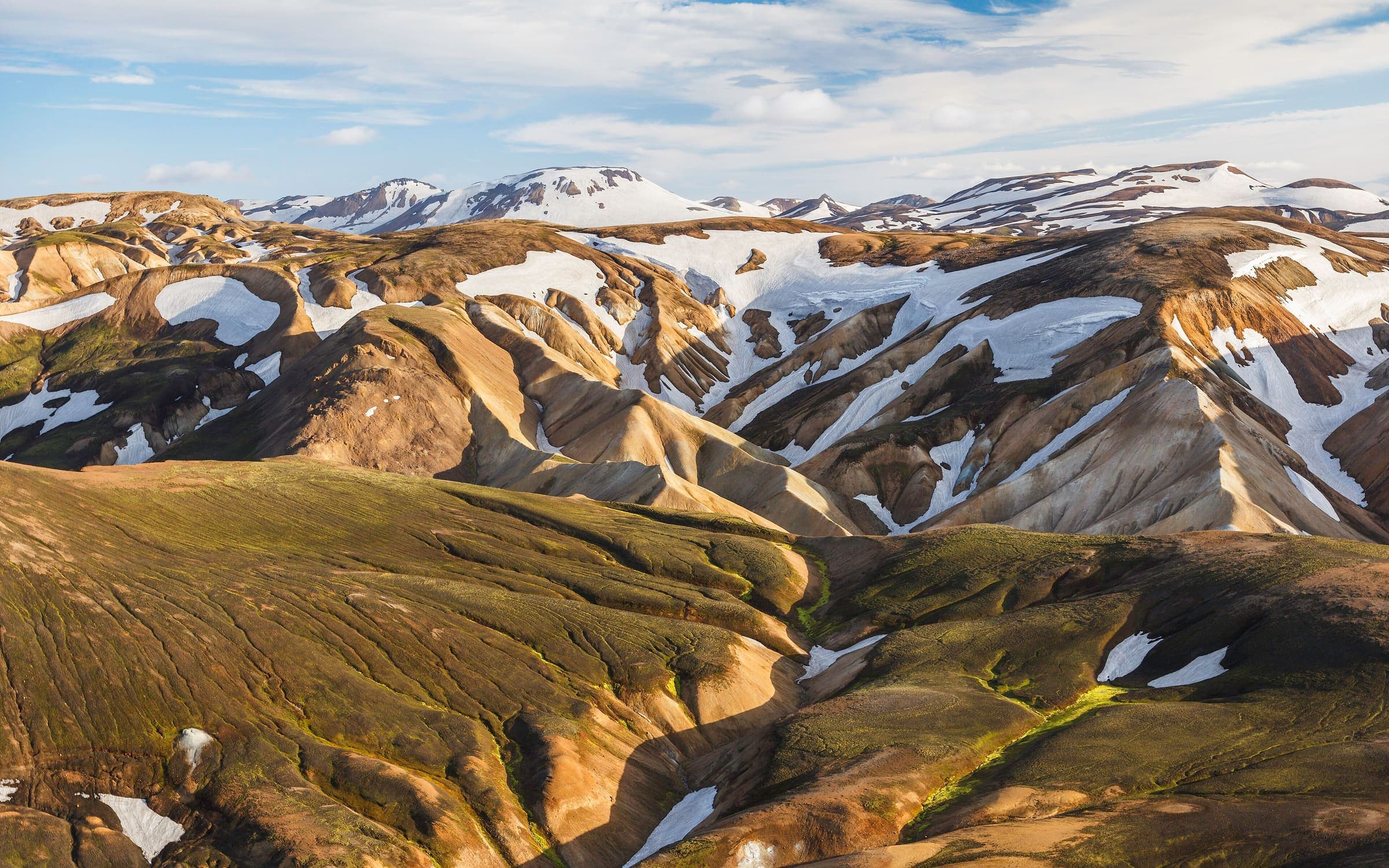
OSM 2D length is 52.8 km (relation 1225037; longest connected component of parent ways after 3 km snap; alternative-role members omitted). A ~2.6 km OSM mapping gap between the Landmannalaugar half and the Þórsmörk half is bridged by that snap — the straight-line connector is included in this length. Published ~55 km / 3–4 days (FÍ, https://www.fi.is/en/hiking-trails/trails/laugavegur, checked 2026-08-24) are cross-checks only, not this DataPoint. OSM tags distance=54. Wikidata Q151268 is the highland trek (Landmannalaugar–Þórsmörk), not Reykjavík's shopping street.
typicalDays 4 is the published typical: FÍ says the trail is most popularly hiked over four days, with two- and three-day options (https://www.fi.is/en/hiking-trails/trails/laugavegur, checked 2026-08-24). Range 2–4 days; not a DataPoint. FÍ: on average the trail is open 25 June–15 September (same page, snow/road dependent).
Water was not mapped to named WaterSource points (no honest atFraction). Glacial streams are frequent on published descriptions but were not positioned from an official stage list this pass.
Water
No water sources recorded.
Surface
Surface is not recorded. This field is filled only from an OSM surface tag, not from the grade.
Permits & fees
Permit status is unverified. Permit fields were not sourced from OSM. Confirm locally before travel. Ferðafélag Íslands (https://www.fi.is/en/hiking-trails/trails/laugavegur, checked 2026-08-24) describes hut and campsite bookings and river crossings but does not state a walking-permit requirement; left unverified rather than asserted. Hut/campsite advance booking (including tent spots) is logistics, not a trail permit. There is no walking fee on that page.
Getting there
Sourced legs to the Landmannalaugar (OSM line start) base start station — where this trail record begins. This is not a route planner: durations are approximate and marked provisional until an official transport page confirms them.
Road · Keflavík (KEF) → Reykjavík
Airport coach or bus to Reykjavík. No rail in Iceland.
en.wikipedia.org · verified 2026-08-24 · wikidata · official · provisionalBus · Reykjavík → Landmannalaugar
Seasonal highland bus in the hiking season (late June to early September). FÍ does not name a single operator (https://www.fi.is/en/hiking-trails/trails/laugavegur, checked 2026-08-24). Return buses also run from Þórsmörk.
fi.is · verified 2026-08-24 · official · provisional
No rail. Highland F-roads need an authorised 4x4 if self-driving; FÍ notes a parking service fee at Landmannalaugar (checked 2026-08-24).
Plan from your location
Type a city, then pick a match. These links open external search tools — they do not fetch fares or timetables.
Getting there car-free
- Start (OSM line): car-free flag unknown. No transit note stored, so this is not a way to get there.
- End (OSM line): car-free flag unknown. No transit note stored, so this is not a way to get there.
Trailheads
- Start (OSM line) car-free: unknown
- End (OSM line) car-free: unknown
Log in to view trailhead transit detail
Hazards
- Unbridged river fords: FÍ says at least three rivers must be waded and can rise quickly after rain (https://www.fi.is/en/hiking-trails/trails/laugavegur, checked 2026-08-24).
- Rapid weather change and exposure on the southern highland plateau, including whiteout in wind and low cloud (FÍ same page; Safetravel / ICE-SAR, https://safetravel.is/, checked 2026-08-24).
- Snow-covered sections occur on the trail (FÍ gear list, same page, checked 2026-08-24). Early-season snow on the high plateau is a published lead, not a surveyed elevation.
- File a travel plan at safetravel.is before highland walking (ICE-SAR Safetravel, https://safetravel.is/, checked 2026-08-24).
Questions
Do I need a permit for Laugavegur?
Permit status is unverified for Laugavegur. This desk does not assert that a walking permit is or is not required.
When is the best time to hike Laugavegur?
On this record the best season is: Huts open ~25 Jun–15 Sep (snow/road dependent).
How difficult is Laugavegur?
Laugavegur is graded FÍ: moderate–challenging (no official SAC) · SAC T2 (mapped — no official SAC grade) · YDS 1. A sourced hazard on this record: Unbridged river fords: FÍ says at least three rivers must be waded and can rise quickly after rain (https://www.fi.is/en/hiking-trails/trails/laugavegur, checked 2026-08-24).
How long is Laugavegur?
The OSM 2-D length on this record is 52.8 km (provisional). Published figures may differ. See /guides/how-long-is-the-trail
How do I get to Laugavegur?
The record’s base start is Landmannalaugar (OSM line start). A primary gateway on the record is Keflavík International Airport (KEF). Trailhead transit notes are not included in this public FAQ.
Related trails
- Ala-Kul Lake Trek · Same collection
- Alta Via 1 · Same collection
- Everest Base Camp · Same collection
- Fishermen's Trail · Same collection
- GR20 · Same collection
- Inca Trail (Classic 4-day) · Same collection
Featured in
- How long is the trail, really?
- Permit & season calendar
- How hut-to-hut booking works
- Difficulty scales and surface
- Seasonality on the catalog
- Water sources on the catalog
- Car-free and transit access
- Government fees and operator markup
- Iconic bucket-list treks
- Hut-to-hut treks in Europe
- Car-free long-distance hikes
- Low-altitude treks
- High-infrastructure treks